People planning to visit Whitefish Island are being asked to use extreme caution.
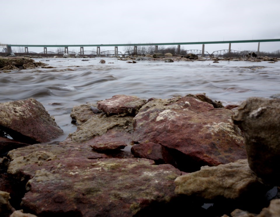
The International Lake Superior Board of Control says low lying areas, including some recreational trails, are flooded.
Batchewana First Nation has shut down access to some parts of the island.
“The gate setting of the Compensating Works at the head of the St. Marys Rapids will be maintained at the current setting equivalent to approximately eight gates fully open,” said the board in a news release.
“The flow will remain at approximately 1,200 m3/s for the month of June.”
For further details, please see the news release below:
Anglers and other users of the St. Marys Rapids, please be advised that the gate setting of the Compensating Works at the head of the St. Marys Rapids will be maintained at the current setting equivalent to approximately eight gates fully open. The St. Marys Rapids flow will remain at approximately 1,200 m3/s for the month of June.
Low-lying areas of Whitefish Island including recreational trails are currently flooded and portions of the Island have been closed by Batchewana First Nation. Users are encouraged to use extreme caution. The Board advises that even higher flows in the St. Marys Rapids are possible in the coming months, which may increase the level of flooding on Whitefish Island.
The International Lake Superior Board of Control (Board) received approval from the International Joint Commission (IJC) to temporarily deviate from Regulation Plan 2012 through November 2023. This deviation strategy is similar to the strategy employed in 2019. Over the next several months, the Board will continue to adjust the gate settings at the Compensating Works in order to offset the flow limitations caused by repairs and maintenance at the hydropower plants. The total amount of water released through the St. Marys River will be approximately equal to the flow prescribed by Plan 2012 and the deviation strategy will have almost no cumulative impact on the water levels of Lake Superior and Lake Michigan-Huron yet will provide reduced fluctuations in flows and water levels in the St. Marys Rapids, directly downstream of the Compensating Works.
The Board expects the total St. Marys River flow in June to be 2,950 m3/s (104,200 cfs) which is 150 m3/s (5,300 cfs) less than the flow prescribed by Regulation Plan 2012. Actual hour-to-hour and day-to-day flows may vary depending on hydrologic conditions, as well as variations in flow from the hydropower plants.


