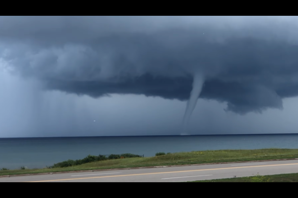
People in the Straits area, including Mackinac Island and Bois Blanc Island, witnessed a waterspout forming and then touching down over Lake Huron earlier today. It eventually tracked southeast to offshore of Cheboygan.
Many pictures and videos were taken of the unique occurrence. Russ Rickley was one of the lucky ones to capture the storm as it moved offshore from Mackinac County and the actual formation of the water spout.
Waterspouts fall into two categories: fair-weather waterspouts and tornadic waterspouts.
Tornadic waterspouts are tornadoes that form over water or move from land to water. They have the same characteristics as a land tornado. They are associated with severe thunderstorms and are often accompanied by high winds and seas, large hail, and frequent dangerous lightning.
Fair-weather waterspouts usually form along the dark flat base of a line of developing cumulus clouds. This type of waterspout is generally not associated with thunderstorms. While tornadic waterspouts develop downward in a thunderstorm, a fair weather waterspout develops on the surface of the water and works its way upward. By the time the funnel is visible, a fair-weather waterspout is near maturity. Fair-weather waterspouts form in light wind conditions so they normally move very little.
If a waterspout moves onshore, the National Weather Service issues a tornado warning, as some of them can cause significant damage and injuries to people. Typically, fair-weather waterspouts dissipate rapidly when they make landfall and rarely penetrate far inland.
The National Weather Service in Gaylord said that this specific waterspout was most likely a fair-weather waterspout. Very cold air aloft rides over the warmer waters of Lake Huron/Straits and creates enough energy and instability to form the waterspout.


